Riverside County
Search clues: parcel/APN, owner
First file to inspect: Any Riverside County OWTS permit or Land Use Permit Look Up record tied to the parcel.
Start with the permit file, as-built, site sketch, or approved plan. Those records can show the tank, drain field, reserve area, and access notes; if they do not, arrange a professional locate instead of guessing.
A full address resolves the county and starts the official route. If the public search stops, SepticPath can investigate the record and contact the responsible office for you.
When a direct file exists: The original record still opens on the government or county site. Otherwise the official route may require a search, form, call, login, or request there; this page keeps your place for 30 days.
Your answer stays on this device for 30 days so the next visit can continue from here.
Add a downloaded file, phone screenshot, or text copied from the official page or email. Each source updates one shared checklist and shows conflicts between records.
PDF, TXT, PNG, or JPG; maximum 10 MB per source. Originals and OCR images are never saved. The extracted summary stays only in this tab unless you choose “Save session for later.”
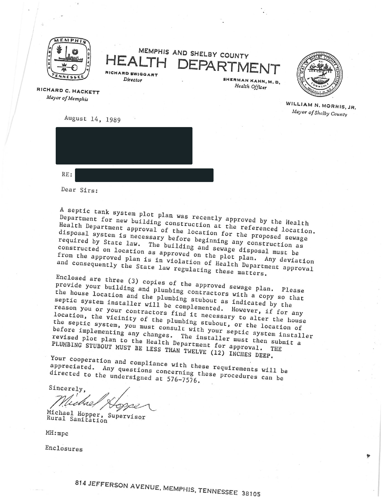
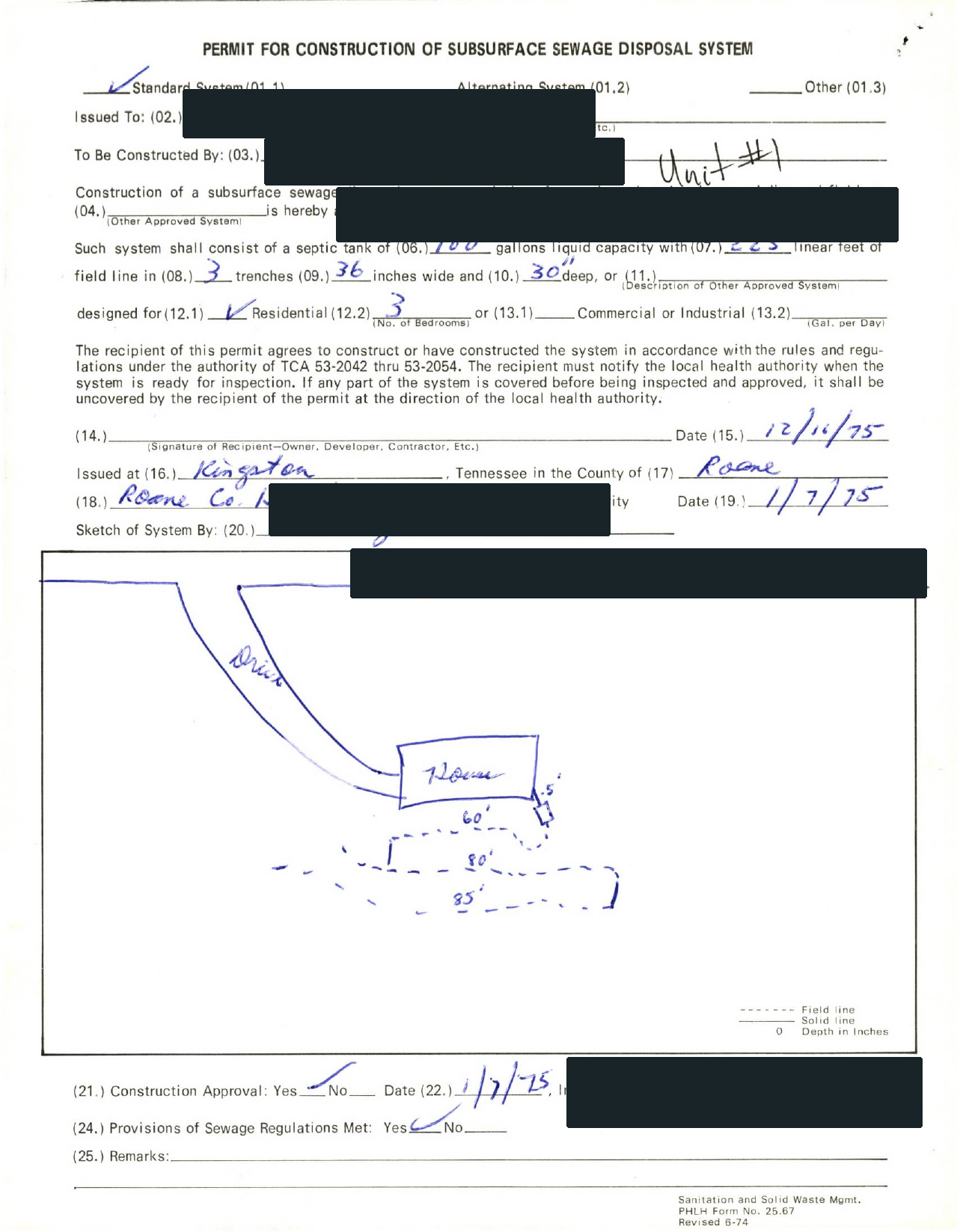
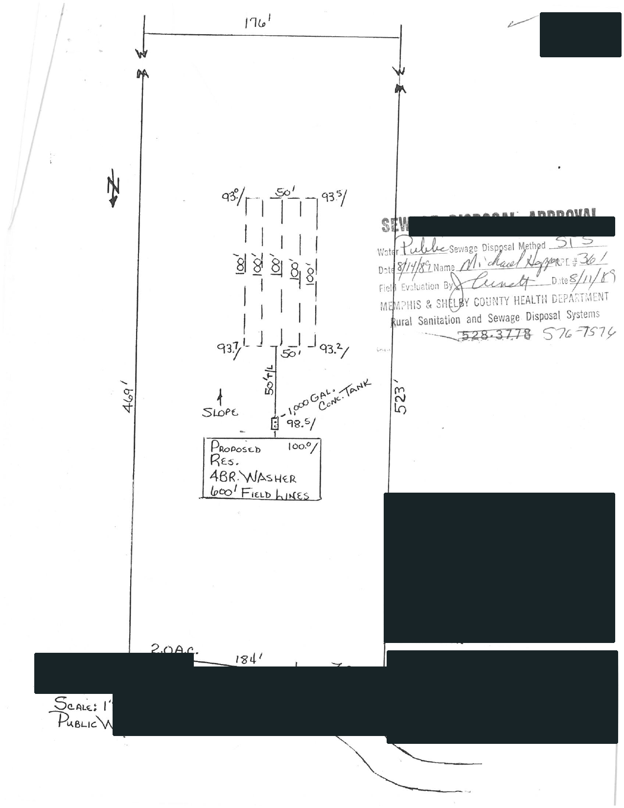
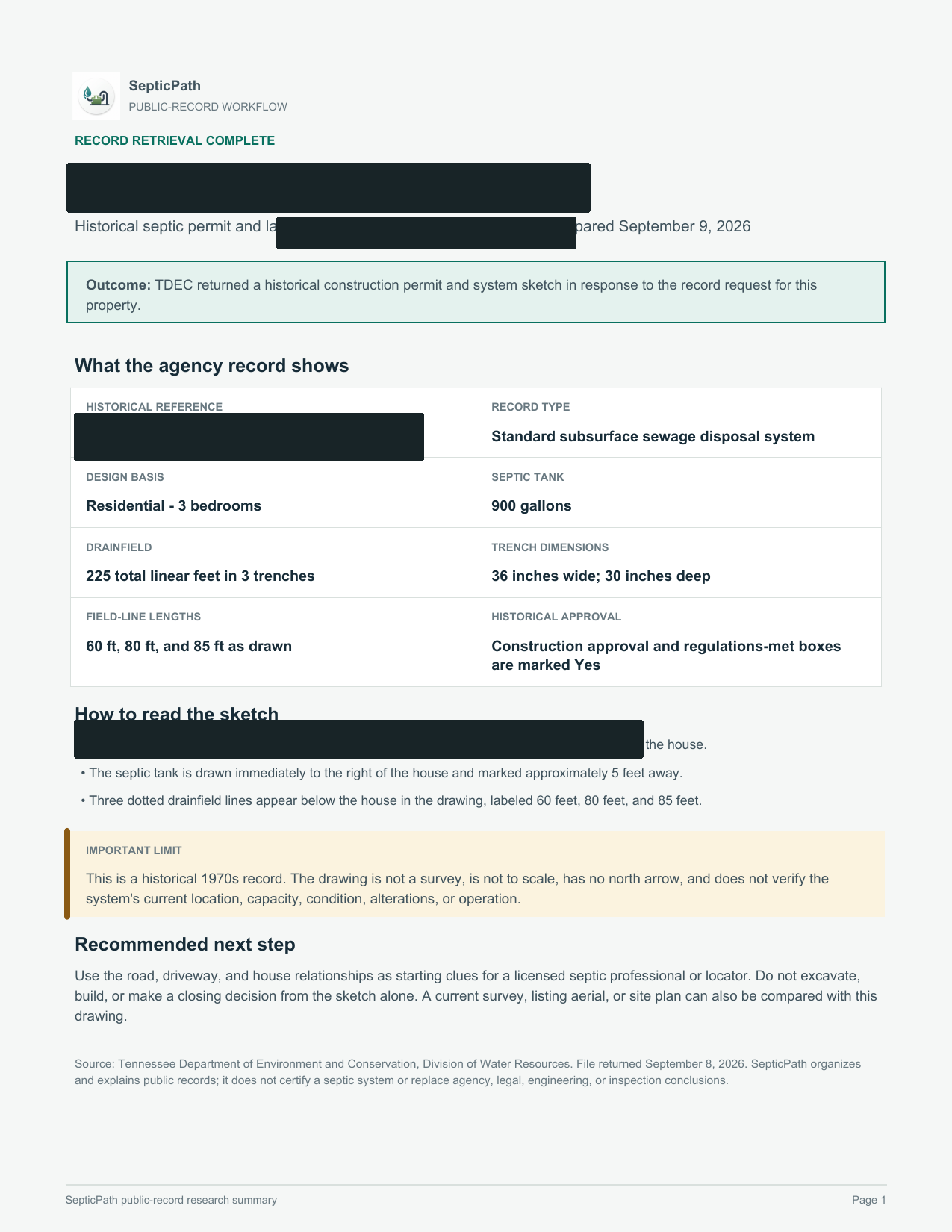
Selected full pages from separate completed requests: original agency records, hand-drawn plans, and the brief delivered after review.
Swipe to compare the original pages Document 1 of 3
What this helps withA starting point for discussing the layout with a septic professional.
What it does not proveThis is an approved design, not proof of the system’s current location or condition.
Open the delivered brief ↗Privacy reviewed: black bars remove identifying details; agency language, form structure, system data, and drawing geometry remain visible. Samples are from separate requests, not one property file. Record availability varies by property and jurisdiction.
Government archives may be indexed under an earlier owner, parcel, subdivision, lot, legal description, or permit number. A failed address search is not proof that no file exists.
These are reviewed government map, GIS, parcel, and direct permit-search routes. A mapped point or permit hit is evidence to inspect—not a field locate or proof of current condition.
Search clues: parcel/APN, owner
First file to inspect: Any Riverside County OWTS permit or Land Use Permit Look Up record tied to the parcel.
Search clues: parcel/APN, owner
First file to inspect: Any use permit, OWTS inspection report, or county permit file tied to the parcel.
Search clues: parcel/APN, owner
First file to inspect: The septic system location map and any current county permit or clearance tied to the parcel.
Search clues: address, parcel/APN, owner
First file to inspect: The septic-system sketch shown for the parcel, when available.
Search clues: parcel/APN, owner
First file to inspect: Any scanned well and septic permit records linked from the Garrett parcel map.
Search clues: address, parcel/APN, owner
First file to inspect: Any St. Mary's GIS-linked environmental health records for the parcel.
Search clues: parcel/APN, owner
First file to inspect: Any scanned sanitary permit or septic record available through the county Land Explorer.
Search clues: parcel/APN, owner
First file to inspect: Any county OWTS permit or project history tied to the parcel through the Permit Lookup Tool.
Search clues: address, parcel/APN, owner
First file to inspect: Any septic permit information surfaced through Missoula County Property Fast Facts for the parcel.
Search clues: address, parcel/APN, owner
First file to inspect: Any Tioga County septic permit or related public-health file tied to the parcel.
Search clues: address, parcel/APN, owner
First file to inspect: Any operation permit or EH Permits record visible in Craven GIS for the parcel.
Search clues: parcel/APN, owner
First file to inspect: Any Hocking County STS permit or map-based permit-history record tied to the parcel.
Search clues: address, parcel/APN, owner
First file to inspect: Any Bear River Health septic permit, alteration, or repair file tied to the parcel.
Search clues: parcel/APN, owner
First file to inspect: Any recorded deed, plat, survey, or property document tied to the parcel.
Search clues: parcel/APN, owner
First file to inspect: Any Washington County septic permit or inspection history surfaced through the county map service.
Search clues: parcel/APN, owner, permit number
First file to inspect: Any site evaluation recommendation, improvement permit, onsite wastewater permit, repair permit, or operation permit tied to the parcel.
Search clues: address, parcel/APN, owner, permit number
First file to inspect: The Franklin County OSW database result tied to the property, including permit number, PIN, address, owner, type, status, and any completed forms.
Search clues: address, parcel/APN, owner, permit number
First file to inspect: The 2004-present public-portal permit record, including the address, parcel number, septic permit type, status, and available attachments.
Search clues: parcel/APN, owner
First file to inspect: The septic permit image and permit status tied to the property.
Search clues: address, parcel/APN, owner
First file to inspect: The Aiken County parcel anchor: TMS or parcel ID, owner, address, subdivision, property card, GIS map, or tax-map clue from the official county source.
Search clues: address, parcel/APN, owner
First file to inspect: The Anderson County parcel anchor: TMS or parcel ID, owner, address, subdivision, property card, GIS map, or tax-map clue from the official county source.
Search clues: address, parcel/APN, owner
First file to inspect: The Beaufort County parcel anchor: TMS or parcel ID, owner, address, subdivision, property card, GIS map, or tax-map clue from the official county source.
Search clues: address, parcel/APN, owner
First file to inspect: The Berkeley County parcel anchor: TMS or parcel ID, owner, address, subdivision, property card, GIS map, or tax-map clue from the official county source.
Search clues: address, parcel/APN, owner
First file to inspect: The Dorchester County parcel anchor: TMS or parcel ID, owner, address, subdivision, property card, GIS map, or tax-map clue from the official county source.
Search clues: address, parcel/APN, owner
First file to inspect: The Florence County parcel anchor: TMS or parcel ID, owner, address, subdivision, property card, GIS map, or tax-map clue from the official county source.
Search clues: address, parcel/APN, owner
First file to inspect: The Greenville County parcel anchor: TMS or parcel ID, owner, address, subdivision, property card, GIS map, or tax-map clue from the official county source.
Search clues: address, parcel/APN, owner
First file to inspect: The Horry County parcel anchor: TMS or parcel ID, owner, address, subdivision, property card, GIS map, or tax-map clue from the official county source.
Search clues: address, parcel/APN, owner
First file to inspect: The Pickens County parcel anchor: TMS or parcel ID, owner, address, subdivision, property card, GIS map, or tax-map clue from the official county source.
Search clues: address, parcel/APN, owner
First file to inspect: The Richland County parcel anchor: TMS or parcel ID, owner, address, subdivision, property card, GIS map, or tax-map clue from the official county source.
Search clues: address, parcel/APN, owner
First file to inspect: The Spartanburg County parcel anchor: TMS or parcel ID, owner, address, subdivision, property card, GIS map, or tax-map clue from the official county source.
Search clues: address, parcel/APN, owner
First file to inspect: The York County parcel anchor: TMS or parcel ID, owner, address, subdivision, property card, GIS map, or tax-map clue from the official county source.
No matching public tool in the reviewed set. Clear the filters or use the county request route below.
Use the county finder below for request forms, office contacts, and written no-record follow-up.
Use this when you know the state or county but do not have a complete property address.
No matching county route yet. Try the state name, a nearby county, or open the state records lookup.
Save the original. Compare the address and parcel, permit number, approved use or bedrooms, installed layout, final approval, and later repairs. Do not infer current condition from an old permit.
Retry with alternate identifiers, then contact the office. Only a written office response should be treated as a confirmed no-record result.
Name the missing artifact and request it directly. If the installed layout or current condition still cannot be established, a professional locate or inspection may be the next step.
Independent guide. SepticPath is not a government agency and does not certify record existence, compliance, or system condition. Last review activity: 2026-07-26
Start with the county or state permit file and ask for the as-built, site sketch, approved plan, final approval, or scanned attachment by address, parcel, or owner name. If the file does not locate the system, use a qualified professional locate.
Sometimes, but the permit title alone may not. The useful attachment is usually the as-built, site sketch, record drawing, approved plan, or final approval showing the installed layout.
Ask the office for archived or pre-digital files and a written no-record response. If no reliable drawing exists, arrange a qualified locate before digging, building, repairing, or relying on an assumed location.